Loveland Pass
Elevation - 11,990ft
39°39′49″N 105°52′45″W
39°39′49″N 105°52′45″W
Located along the Interstate 70 corridor, Loveland Pass can be a deceptive and challenging place to cross the Continental Divide. Nearest AWOS is Berthoud Pass (134.325 / 303-512-4416) and Copper Mountain (118.075 / 970-968-1715).
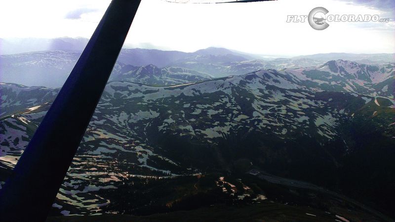
Remarks: Loveland Pass follows Highway 6 north / south over the Continental Divide. NOTE: Crossing west over Loveland Ski Area and I-70, where the ridge can exceed 13,000ft, is not recommended. Use caution: If high winds exist, extreme turbulence and severe downdrafts are likely. Even on good weather days, this area is hazardous and to be flown with great diligence (many fatal accidents have occurred here). Use caution: Grizzly Peak (13,427ft) 1.8NM to the southeast, Mount Sniktau (13,234ft) 1.3NM to the northeast, and the basin ridge (12,570ft) 0.5NM to the west. Multiple mountains over 14,000ft to the east.
Remarks: Loveland Pass follows Highway 6 north / south over the Continental Divide. NOTE: Crossing west over Loveland Ski Area and I-70, where the ridge can exceed 13,000ft, is not recommended. Use caution: If high winds exist, extreme turbulence and severe downdrafts are likely. Even on good weather days, this area is hazardous and to be flown with great diligence (many fatal accidents have occurred here). Use caution: Grizzly Peak (13,427ft) 1.8NM to the southeast, Mount Sniktau (13,234ft) 1.3NM to the northeast, and the basin ridge (12,570ft) 0.5NM to the west. Multiple mountains over 14,000ft to the east.
Other nearby passes: Vail Pass, Corona/Rollins Pass, and Kenosha Pass.